
Welcome to WMO Centre of Excellence for Training in Satellite Meteorology (CoE- Barbados) located at Caribbean Institute for Meteorology and Hydrology (CIMH) in Barbados. The CoE serves the Caribbean Meteorological Organization (CMO) 16 Member States (www.cimh.edu.bb) of the CMO as well as a host of Regional agencies who benefit either directly or indirectly from the products and services of the CIMH.
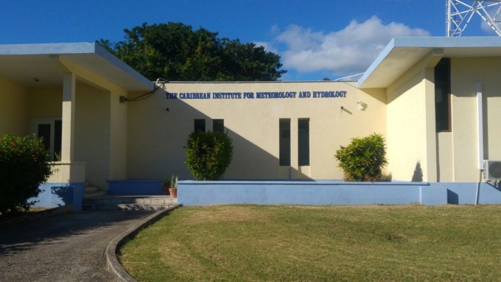
The CIMH is the technical Organ of the Caribbean Meteorological Organization (CMO). Orginialy the CMI was established in 1967, and officially became an Organ of the CMO in 1973. The CIMH is recognized as an Institution of the Caribbean Community In addition, the CIMH has been an affiliate of the University of the West Indies (UWI) since 1973. Under the affiliate arrangement, the CIMH is responsible for the delivery of the B.Sc. in Meteorology at the UWI Cave Hill Campus.
The CIMH is managed by a Board of Governors which is comprised of a member drawn from each of the 16 Member States of the CMO – Guyana, Trinidad and Tobago, Grenada, St. Vincent and the Grenadines, Barbados, Saint Lucia, Dominica, Antigua and Barbuda, Anguilla, St. Kitts and Nevis, Montserrat, the British Virgin Islands, Jamaica, the Turks and Caicos Islands, the Cayman Islands and Belize.
The mandate of the CIMH is “to improve the meteorological and hydrological services and to assist in promoting the awareness of the benefits of these services for the economic well-being of the CMO countries. This is achieved through training, research and investigations, and the provision of specialized services and advice”.
The CIMH website is one of the main sources for providing information to the CMO Member States on the training and research opportunities available at the institutions. The website is also one of the main avenues for the institute to showcase the various activities, services, and events available at the institute.
About the Caribbean Institute for Meteorology and Hydrology
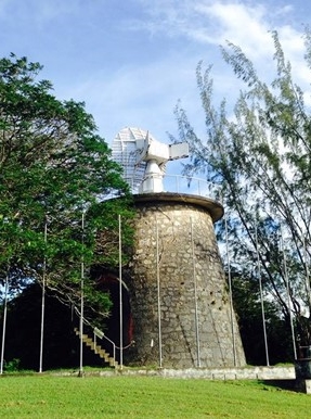
The CIMH is an Institution of the Caribbean Community (CARICOM) and the technical Organ of the Caribbean Meteorological Organization (CMO). The CIMH functions as:
- The World Meteorological Organization (WMO) Regional Training Centre for the Caribbean;
- A centre for applied research and development in meteorology, hydrology/water resources, climatology and related areas including disaster risk reduction and impacts forecasting;
- The WMO Regional Instrument Centre for the Caribbean;
- A WMO Centre of Excellence for Training in Satellite Meteorology;
- The WMO Regional Climate Centre (RCC) for the Caribbean;
- The Caribbean Centre for Climate and Environmental Simulations;
- The Climate Data Archive for CMO Member States;
- A Marine Forecast Support Centre for the Caribbean;
- The Pan American Centre for the WMO Sand and Dust Storm Warning Advisory and Assessment System (SDS-WAS).
CoE Barbados
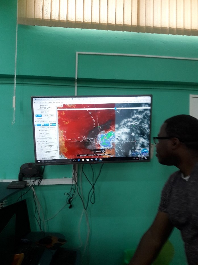
In the late 1990s as part of a commitment to the World Meteorological Organization (WMO), the Cooperative Institute for Research in the Atmosphere (CIRA) partnered with the WMO Regional Meteorological Training Centres of Excellence (RMTCoE) in Barbados (Caribbean Institute for Meteorology and Hydrology – CIMH) and Costa Rica (University of Costa Rica – UCR) to provide high-resolution satellite data.
Initially, the data were used for research in developing a cloud climatology for the two regions. The concept soon expanded to provide both online case study data and near real-time data through the use of RAMSDIS specialised software and data analysis systems. It was also recognised that there was a need to share training materials and lectures as well. The establishment of the Virtual Laboratory for Training and Education in Satellite Meteorology (VLab) in 2000, which now involved other CoEs, can be traced back to these activities.
Led by Selvin and Horace Burton, the CoE Barbados was therefore at the forefront of the establishment of the VLab and the International Satellite Data Utilization and Training Focus Group which coordinates and oversees the VLab.

CoE Achievements
For the CIMH, one of the major successes of the utilisation of the VLab was the Caribbean weather briefing which was developed out of a recommendation from the participants of the Satellite Training Workshop held in Barbados in December 2003. With the formation of a focus group, this monthly online discussion, in English, was coordinated by the CIMH with support from CIRA. The focus group later evolved to what is now the Americas and Caribbean Focus Group with the discussion expanded to include monthly bi-lingual and Spanish only and runs to this day in 2022.
The VLab also played a significant role in research undertaken at the CIMH. It was greatly utilised in a case study of a heavy rainfall event in St. Lucia during October 1996. The study explored the use of high-resolution satellite imagery and derived products in the analysis and forecasting of tropical weather systems and offered guidelines on how to incorporate these new tools into the analysis and forecast process.
Ms Kathy- Ann Caesar served as co-chair of the WMO Virtual Laboratory (VLab), from 2010 to 2016 and was instrumental in the organization of the VLab the Caribbean Aviation Week in 2012 and the Virtual Roundtable Event in 2013. The Virtual Roundtable event planned a series of presentations on all relevant information on Aeronautical Competency standards for the operational personnel. The most interesting aspect of the event is that it is presented in various official WMO languages.
The CoE hosted the CIMH/NOAA/SWFDP Americas’ Satellite Workshop, 22 to 25 July 2019, this being focused on the use of the Next Generation of Satellite Imagery. The workshop demonstrated the use of satellite images and products from GOES East ABI and the Joint Polar Satellite System (JPSS) data and products for forecasting mesoscale events and tropical cyclone severe weather. There was also a component on access to satellite data via GEONETCast- Americas (GNC-A) and other sources via the internet. The third workshop hosted by CoE Barbados was the EUREC4A Forecaster Proving Ground, in preparation for the 2020 EUREC4A Project and focused on the use of forecasting tools such as satellite imagery and NWP mesoscale models in forecast preparation. The latest in the series of SWFP workshops was the SWFP-EC Virtual Workshop – November 08th to 12th, 2021.
CoE Barbados also utilises satellite imagery from NASA to support various activities in hydrology. This is used in the identification of inundation areas resulting from flooding events; the identification of blockages in watercourses resulting from landslides; and the identification of land cover/land cover changes and estimation of hydrological parameters imagery also supports hydrological modelling by providing a visualization of watershed characteristics. As well as the use of satellite-derived precipitation data to provide the potential for a flood.
Conclusion
CoE Barbados continues to look at innovative uses of satellite data including exploring the use of satellite data in monitoring and mapping the effects of Climate change in the Caribbean. There will also be talks on collaboration with the Tomorrow.io company on the first global high- Low Earth Orbit, (LEO) space-based weather radar satellite constellation.
Affirming its role as a Regional Training Centre the CoE continues to build on its technology hardware and software resources. The CoE hosts several programs and systems which also give students hands-on experience. Most recently, the CoE invested in a METLAB Weather Observation and forecasting System which will be merged with the GEONETCast receiver system allowing easier access to NOAA satellite products and booster the available data for training and research.
CoE Contact Information
Dr. David Farrell
Principal
Ms Kathy-Ann Caesar
Chief Meteorologist