The National Institute for Space Research (INPE) is a Research Unit of the Ministry of Science, Technology and Innovation (MCTI) that has carried out, since 1961, scientific research, technological development, operational and training activities in the fields of space and atmospheric science, weather forecasting and climate studies, space engineering and technology, earth observation and related fields.
INPE’s Mission is to promote and carry out studies, scientific research, technological development and training of human resources, in the fields of Space Science and the Atmosphere, Space Applications, Meteorology and Space Engineering and Technology, as well as in related domains, as the policies and guidelines defined by the Ministry of Science, Technology and Innovation. The activities currently developed by INPE seek to demonstrate that the use of space science and technology can influence the quality of life of the Brazilian population and the development of the country.
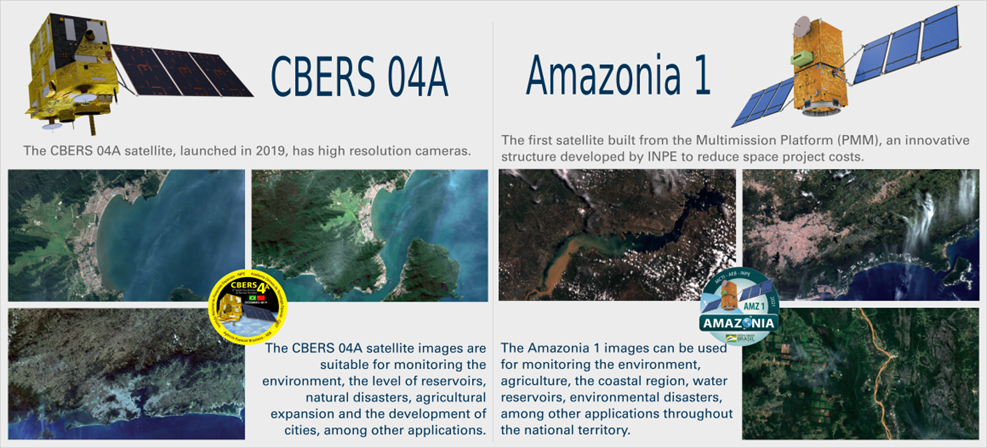
Among the satellites operated and developed by INPE are the CBERS program and the Amazonia 1 satellite.
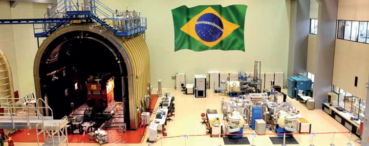
Integration and Testing Laboratory (LIT) of the Integration and Testing Assembly Coordination (COMIT) of INPE, in operations since December 2, 1987.
CBERS: China-Brazil Earth-Resources Satellite
The CBERS satellites are used for climate monitoring, systematization and land use projects, management of water resources, images for licensing and environmental monitoring, among other applications. The images are used in Brazil, by private companies and governmental institutions. Since 2001, a policy of free distribution of CBERS images has been established for all Brazilian users. This significance is attested by the more than 15,000 users from more than 1,500 institutions registered as active users of CBERS, and also by the more than 300,000 CBERS images distributed at an approximate rate of 250 per day among public organizations, universities, institutions, research centers and NGOs. The CBERS family of remote sensing satellites has brought significant scientific advances to Brazil.
The images are used from controlling deforestation and fires in the Legal Amazon, to monitoring water resources, agricultural areas, urban growth and land use and it is fundamental for large strategic national projects.
Amazonia 1:
Although not the first Brazilian satellite, it is the first designed, produced and tested entirely in the country. It is the third Brazilian remote sensing satellite in operation with CBERS-4 and CBERS-4A, both produced in partnership with China.
The Amazonia 1 satellite has the following characteristics:
Polar orbit
Planet imaging period: 5 days
Wide view optical imager (3-band camera on VIS and 1-band on NIR)
Observation range: 850 km with 60 meters resolution.
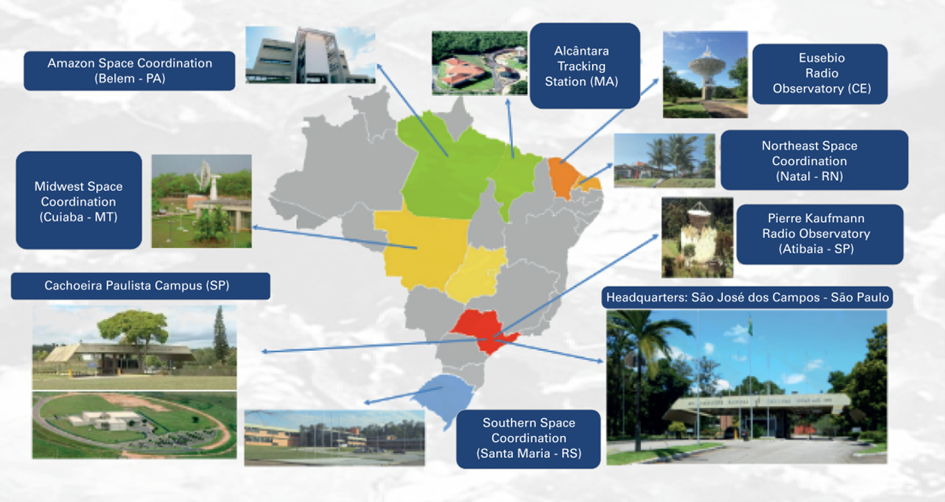
INPE has its headquarters located in São José dos Campos - SP with activities developed in the five regions of the country. Between 2019 and 2020, INPE underwent a process of organizational restructuring as a way of preparing for the challenges of the coming decades
INPE’s history of major initiatives reflects the proactive stance of its scientific community, which gradually expanded the institution’s area of activity in response to society’s demands and scientific and technological challenges. The competence acquired in its main areas of activity – Space and Atmospheric Sciences, Environmental and Meteorological Sciences, and Space Engineering and Technologies – were established, on the one hand, thanks to international scientific cooperation.
On the other hand, it took advantage of the establishment of a scientific and technological community of excellence that was established under the strategy of training in the most advanced research centers and by attracting researchers from abroad to work at the institution.
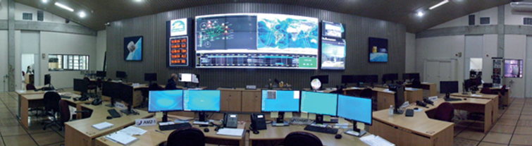
Coordination of Tracking, Control and Reception of Satellites